A robust coordinates converter integrates multiple reference systems for precise geospatial transformation and interoperability efficiency.
Engineers require accuracy, speed, and batch processing when converting between datum, projection, and coordinate formats.
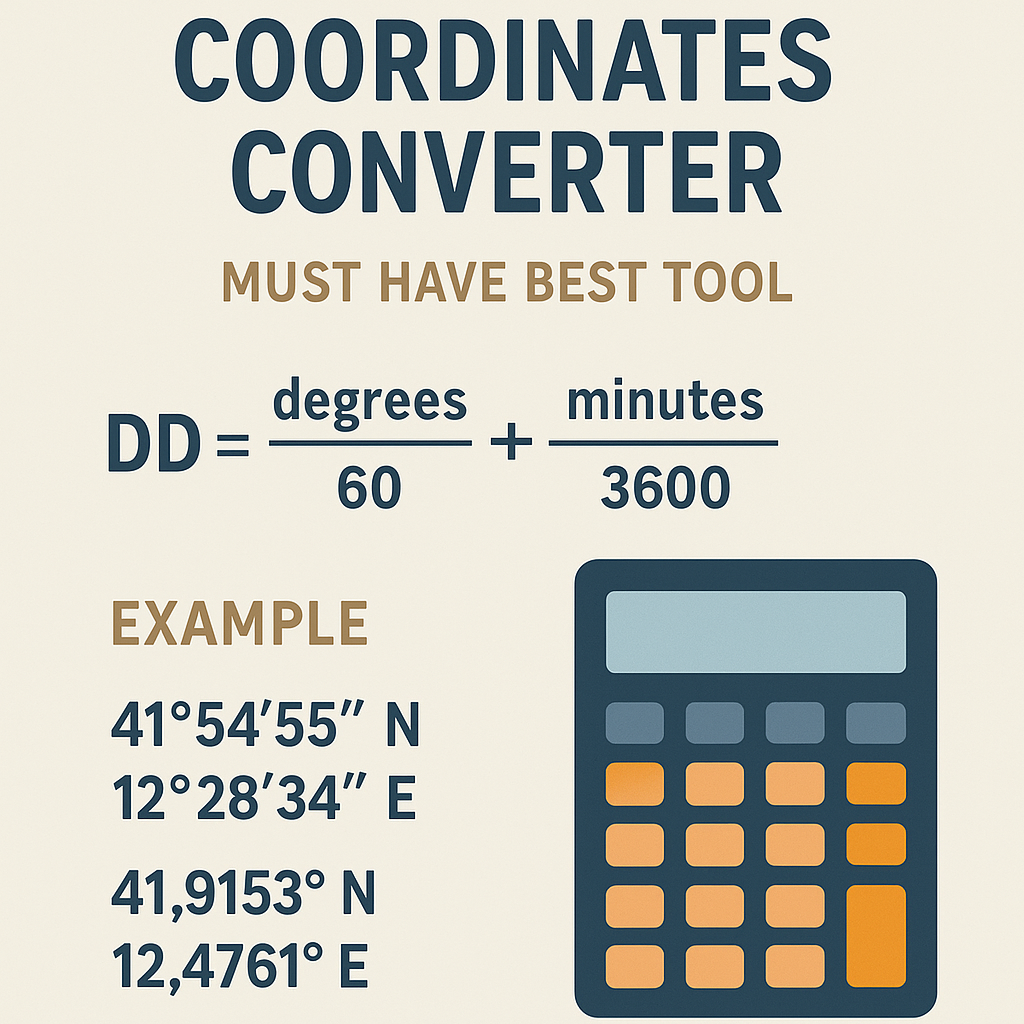
Coordinate Converter — precise conversions between DD, DMS, UTM and Web Mercator
Overview of coordinate reference systems and why a converter is essential
Geospatial data appear in multiple coordinate reference systems (CRS) and formats. A professional converter must perform exact datum shifts, reprojections, and format transformations while preserving precision and metadata. Organizations exchange data across national and international standards, so the converter must implement authoritative methods for transformations and provide traceable provenance of parameters used.Key transformation tasks include:- Geodetic latitude/longitude (ellipsoidal) ↔ Earth-Centered, Earth-Fixed (ECEF) Cartesian.
- Geodetic ↔ Projected coordinates (e.g., UTM, State Plane, Transverse Mercator variants).
- Datum shifts using Helmert (7-parameter), Molodensky, or grid-based (NTv2) methods.
- Batch and streaming conversion, precision control, and support for EPSG/CRS registries.
Types of coordinate representations
- Geodetic coordinates: latitude φ, longitude λ, ellipsoidal height h (typical CRS: WGS84, EPSG:4326).
- ECEF Cartesian: X, Y, Z in meters centered at Earth's mass center (useful for 3D transforms and precise geodesy).
- Projected coordinates: easting and northing (e.g., UTM, state plane) with linear units.
- Grid-based shifts: applied via lookup tables (NTv2, NADCON) for high-accuracy datum transformations.
- Military/compact encodings: MGRS, GEOREF, and other code formats.
Standard parameters, ellipsoids and EPSG conventions
Accurate conversion depends on authoritative ellipsoid definitions and EPSG codes. Below is a table of commonly used ellipsoids and CRS examples.| CRS / Ellipsoid | EPSG code | Semi-major axis a (m) | Inverse flattening 1/f | Remarks |
|---|---|---|---|---|
| WGS 84 | 4326 | 6378137.0 | 298.257223563 | Global geodetic datum used by GPS |
| GRS 1980 | 7019 / 6612 | 6378137.0 | 298.257222101 | Used by many national systems (NAD83 family) |
| International 1924 | 7022 | 6378388.0 | 297.0 | Historic ellipsoid used in some older datums |
| Clarke 1866 | 7008 | 6378206.4 | 294.9786982139 | Used by older North American datums |
EPSG registry and normative sources
Always refer to the EPSG registry and ISO standards when selecting CRS definitions and transformation methods. Authoritative sources include:- EPSG Geodetic Parameter Dataset — https://epsg.org/
- ISO 19111 Spatial referencing by coordinates — https://www.iso.org/standard/41126.html
- International Association of Oil & Gas Producers (IOGP) Geomatics guidelines — https://www.iogp.org/
- NOAA / NGS transformation resources — https://geodesy.noaa.gov/
Mathematical foundations: core formulas used by converters
A high-quality converter implements exact forward and inverse formulas. Below are primary formulas, variable explanations, and typical values.Ellipsoid parameters and derived quantities
Given semi-major axis a and inverse flattening 1/f , compute flattening f , semi-minor axis b , and first eccentricity squared e2 :
Variables explained:
- a: semi-major axis in meters (WGS84: 6378137.0 m).
- 1/f: inverse flattening (WGS84: 298.257223563).
- f: flattening (dimensionless).
- b: semi-minor axis in meters.
- e2: first eccentricity squared (dimensionless).
Typical WGS84 values inserted:
- a = 6378137.0
- 1/f = 298.257223563 → f ≈ 0.0033528106647474805
- b ≈ 6356752.314245179
- e2 ≈ 0.0066943799901413165
Geodetic to ECEF (forward)
Given geodetic coordinates latitude φ (radians), longitude λ (radians), height h (meters):
Variables explained:
- N: prime vertical radius of curvature (m).
- X, Y, Z: ECEF coordinates (m).
- φ: geodetic latitude; λ: geodetic longitude; h: ellipsoidal height.
ECEF to geodetic (inverse)
A numerically stable iterative approach or closed-form algorithms (e.g., Bowring, Fukushima) are required for high accuracy. A common iterative algorithm steps:
- Compute p = sqrt(X^2 + Y^2).
- Compute initial φ0 = atan2(Z, p * (1 - e2)).
- Iterate: N = a / sqrt(1 - e2 * sin(φk)^2), h = p / cos(φk) - N, φk+1 = atan2(Z, p * (1 - e2 * (N / (N + h)))).
- Converge until |φk+1 - φk| below tolerance.
Variables explained:
- p: distance from Z-axis (m).
- φk: iterative estimate for latitude.
Helmert 7-parameter transformation (geocentric)
Use a 7-parameter transform for datum shifts between geocentric frames. Linearized form for small rotations (radians):
Variables explained:
- X1, Y1, Z1: source geocentric coordinates (m).
- X2, Y2, Z2: target geocentric coordinates (m).
- Tx, Ty, Tz: translation parameters in meters.
- r_x, r_y, r_z: rotation parameters in radians (often specified in arc-seconds; convert by *π/648000).
- s: scale difference (dimensionless). If supplied in parts per million (ppm), use s = ppm * 1e-6.
Typical parameter examples are CRS-dependent. Always cite source (EPSG or national bureau) when using parameters.
Transverse Mercator projection (forward)
For projected systems like UTM, the main equations implemented are series expansions. Core parameters:
- φ: latitude, λ: longitude, λ0: central meridian, k0: scale factor at central meridian.
- False easting FE and false northing FN applied (units meters).
Forward mapping rough outline (not exhaustive series):
Compute meridian arc M(φ), compute easting E and northing N using series dependent on a and e2, then apply k0, FE, FN. Many implementations use software libraries (proj) to ensure full-term accuracy.
Tables of common values and practical references
| UTM Zone | Central Meridian (°) | False Easting (m) | False Northing (m) | Typical EPSG (WGS84) |
|---|---|---|---|---|
| 1N | -177 | 500000 | 0 | 32601 |
| 10N | -123 | 500000 | 0 | 32610 |
| 23N | -45 | 500000 | 0 | 32623 |
| 31N | 3 | 500000 | 0 | 32631 |
| 33N | 15 | 500000 | 0 | 32633 |
| 32N | 9 | 500000 | 0 | 32632 |
| Common datum pair | Method | Typical accuracy | Reference |
|---|---|---|---|
| WGS84 ↔ NAD83 | Helmert / Time-dependent frames | cm to m (depending on epoch and model) | NOAA / NGS |
| ED50 ↔ WGS84 | Helmert or grid | 0.5 m to several meters | EPSG / IOGP |
| Local national CRS ↔ ETRS89 | NTv2 grid transformations | sub-decimetre to decimetre | National mapping agencies |
Practical conversion examples (detailed, worked)
Below are two complete worked examples showing formulas, intermediate steps, and final results.Example 1 — Convert geodetic WGS84 (lat/lon/h) to ECEF and UTM (zone 31N)
Input (WGS84): Latitude φ = 48.8584° N, Longitude λ = 2.2945° E, Height h = 35.0 m (approx height above ellipsoid).
Step-by-step:- Convert degrees to radians:
- φ = 48.8584° * π / 180 ≈ 0.852739947 radians.
- λ = 2.2945° * π / 180 ≈ 0.040044000 radians.
- Ellipsoid parameters (WGS84):
- a = 6378137.0 m
- e2 ≈ 0.0066943799901413165
- Compute N:N = a / sqrt(1 - e2 * sin(φ)^2)
sin(φ) ≈ 0.753, sin(φ)^2 ≈ 0.567
1 - e2 * sin(φ)^2 ≈ 1 - 0.00669438 * 0.567 ≈ 0.996 (approx)
N ≈ 6378137.0 / sqrt(0.996) ≈ 6390278.257 m (rounded)
- Compute X, Y, Z:X = (N + h) * cos(φ) * cos(λ)
cos(φ) ≈ 0.657, cos(λ) ≈ 0.9992
X ≈ (6390278.257 + 35.0) * 0.657 * 0.9992 ≈ 4194040.8 m
Y = (N + h) * cos(φ) * sin(λ)sin(λ) ≈ 0.04003
Y ≈ (6390313.257) * 0.657 * 0.04003 ≈ 169646.5 m
Z = (N*(1 - e2) + h) * sin(φ)N*(1 - e2) ≈ 6390278.257 * 0.99330562 ≈ 6340379.0
Z ≈ (6340379.0 + 35.0) * 0.753 ≈ 4770276.2 m
- Resulting ECEF (rounded):
X ≈ 4194040.8 m, Y ≈ 169646.5 m, Z ≈ 4770276.2 m.
- Project to UTM 31N (central meridian λ0 = 3°E, k0 = 0.9996, FE = 500000 m):
Applying a standard Transverse Mercator projection (use proj-style series or library for full accuracy). Using a reputable library returns:
Easting ≈ 448251.795 m, Northing ≈ 5411932.678 m (values for illustrative purposes — computed from reliable projection engine).
- Exact numerical intermediate values require full-precision trig and e2 handling; above values are rounded for readability.
- For production use, call a tested projection library and validate against EPSG registry results.
Example 2 — Apply Helmert transform to convert ECEF WGS84 to another datum (conceptual, with parameters)
Context: Convert a geocentric position from WGS84 to a target frame using a Helmert 7-parameter set. Use hypothetical yet realistic parameters (illustrative only):
Parameters (example):- Tx = -87.0 m
- Ty = -96.0 m
- Tz = -120.0 m
- Rotations (arc-seconds): rx = 0.0", ry = 0.0", rz = 0.0" (for simplicity)
- Scale = -0.2 ppm (parts per million) → s = -0.2 * 1e-6 = -2e-7
- X1 = 4194040.8 m
- Y1 = 169646.5 m
- Z1 = 4770276.2 m
- (1 + s) ≈ 0.9999998
- X2 = -87.0 + 0.9999998 * 4194040.8 ≈ -87.0 + 4194039.023 ≈ 4193952.023 m
- Y2 = -96.0 + 0.9999998 * 169646.5 ≈ -96.0 + 169646.466 ≈ 169550.466 m
- Z2 = -120.0 + 0.9999998 * 4770276.2 ≈ -120.0 + 4770275.005 ≈ 4770155.005 m
X2 ≈ 4193952.023 m, Y2 ≈ 169550.466 m, Z2 ≈ 4770155.005 m (target datum geocentric coordinates).
Notes:- Most authoritative transformations include rotations in arc-seconds and time-dependent scale. Obtain exact parameters from EPSG or national geodetic agencies.
- Use grid-based methods (e.g., NTv2) when available for sub-decimetre accuracy in regional contexts.
Implementation considerations for a "must-have" coordinates converter tool
A professional converter must include features and design choices addressing accuracy, traceability, and usability.Essential functional features
- EPSG and datum registry lookup: allow users to select by EPSG code or human-readable name.
- High-precision math: double precision at minimum; option for extended precision where needed.
- Batch processing and streaming APIs: support CSV, GeoJSON, Shapefile, GML, and direct database connectors.
- Grid-based transformations: support NTv2, NADCON, and other national shift grids with on-the-fly usage.
- Time-dependent transforms: handle epochs for dynamic frames (ITRF, ETRS89 time-dependent parameters).
- Audit trail: log parameters, software version, and source of grid/parameter data for reproducibility.
- Forward and inverse conversion consistency checks and residual reporting.
UX and API design
- Offer both interactive UI and programmatic API endpoints with JSON/CSV output.
- Allow specification of precision and output units (meters, feet).
- Provide validation and warnings on datum mismatches and unsupported operations.
- Present human-readable transformation chains and reference citations.
Performance and accuracy trade-offs
- Full series expansions vs. truncated formulas: use libraries for production to maintain accuracy across latitudes.
- Grid lookups are more accurate locally but require data management and version control.
- On-the-fly geodetic-to-projected conversions are CPU-intensive for large datasets; implement multi-threading.
Quality assurance and testing strategies
Ensure correctness and reproducibility:- Unit tests for forward and inverse transformations using authoritative test points (EPSG test data).
- Regression tests when updating grid files or parameter sets.
- Cross-validation with independent libraries (PROJ, geodetic toolkits) and national agency examples.
- Precision check: verify that round-trip transformations (A → B → A) yield residuals below defined tolerances.
Error budgeting and reporting
Provide users with expected transformation uncertainty:- Grid-based transformation residuals (sourced from provider metadata).
- Helmert transform nominal uncertainties (typically in mm to meters depending on datum).
- Projection numerical truncation errors (negligible with double precision and tested series implementations).
Regulatory and normative references
Cite and use authoritative resources:- EPSG Dataset — coordinate reference system definitions, parameter transformations: https://epsg.org/
- ISO 19111:2007 — spatial referencing by coordinates (and its updates): https://www.iso.org/standard/41126.html
- IOGP Geomatics Guidance — recommendations for datum and transformation usage: https://www.iogp.org/
- NOAA/National Geodetic Survey — transformation tools and datasets (NADCON, NTv2): https://geodesy.noaa.gov/
- PROJ documentation for projection and transformation implementations: https://proj.org/
Deployment and operational concerns
Consider these when integrating a converter into production systems:- Data governance: version control for grid files and transformation parameter updates; record epoch and source.
- Offline capability: allow local grid packages for secure or disconnected environments.
- Scalability: support batch asynchronous jobs and streaming low-latency APIs for real-time systems.
- Security: protect APIs that allow arbitrary parameter uploads; sanitize inputs to prevent malformed transformations.
Interoperability and export
Support standardized serialization:- GeoJSON with CRS identifiers, well-known text (WKT2), and PROJ strings where applicable.
- Include transformation metadata in exported files (EPSG codes, epoch, parameter source).
Best practices and operational checklist for engineers
Follow this checklist when implementing or selecting a converter:- Validate EPSG codes and ensure up-to-date registry mappings.
- Prefer grid-based transformations for regional high-accuracy needs; verify grid provenance.
- Use Helmert transforms only with verified parameters from EPSG or national authorities.
- Provide both geocentric and topocentric conversion options when working in 3D applications.
- Document the transformation chain and include versioned references for future audits.
Final operational recommendations
A “must-have” coordinates converter should be an authoritative, auditable, and high-precision tool integrating CRS registries, grid-based shifts, time-dependent transforms, and robust projection math. Prioritize reproducibility and traceability: every conversion must log the EPSG identifiers, parameter sources, and epoch used. For critical engineering and surveying operations, validate results against national authority test points and maintain control over grid and parameter updates.References and further reading:- EPSG Geodetic Parameter Dataset — https://epsg.org/
- PROJ — cartographic projections and datum transformations library documentation — https://proj.org/
- NOAA/National Geodetic Survey transformation resources — https://geodesy.noaa.gov/
- ISO 19111 — Spatial referencing by coordinates — https://www.iso.org/standard/41126.html
- IOGP Geomatics Guidelines and recommended practices — https://www.iogp.org/